Project Highlights
Africa Soils Information System
http://www.africasoils.net
World Agroforestry Centre's Global Research Project on Land Health
Go to website
Project
featured as CGIAR story of the month (Feb 2006)
CGIAR scientists deploy Infra-Red scanners in
fight against hunger: Five developing countries to test new
crop-boosting technique... Learn
more
The
soils lab in a suitcase
A technique previously used by the pharmaceutical industry to
ensure quality control in medicines is taking off as a tool that
is set to radically transform soil mapping in Africa and beyond...
Learn more (See News and media coverage.
|
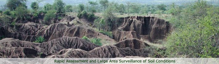
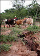
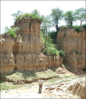
Sensing Soil Condition
Assessment of soil condition requires expensive and
time-consuming measurements in the laboratory and the field. Many
repetitions of the measurements are required to deal with high soil
variability. As a result, scientists have been unable to measure and
monitor soil condition (soil quality/health) and soil degradation over
large areas.
 Our Approach Test of Spectral Library
Approach
Our Approach Test of Spectral Library
Approach
The Project
Sensing Soil Condition is a
technological approach for rapid assessment and large area surveillance
of soil conditions for plant growth and
ecosystem functioning (e.g. hydrological regulation, erosion
regulation, soil biodiversity). The technology is based on rapid
screening of soil condition using
infrared spectroscopy (IR). Soil properties and soil
condition indices are predicted from infrared signatures of soils
compiled into spectral libraries. Spectral libraries constructed from
soils sampled from georeferenced locations may then used in conjunction
with remote sensing imagery to map out soil quality and soil
constraints over entire river basins.
Conventional assessments of soil
capacity to perform specific production, engineering or environmental
functions rely on local calibration of observations on soil functional
attributes to measured soil properties. However, soil analyses are
expensive and dense sampling is required to adequately characterize
spatial variability of an area, making broad-scale quantitative
evaluation difficult. Infrared reflectance spectroscopy, especially
near infrared spectroscopy (NIR), is now routinely used for rapid
non-destructive characterization of a wide range of materials in
industry. Although soil scientists have investigated reflectance
spectroscopy for several decades, the technology has not been widely
taken up and routinely applied in soil studies.
Our research focuses primarily
on application of infrared spectroscopy in risk-based approaches to
soil evaluation-approaches that explicitly consider uncertainty in
prediction and interpretation of soil properties. We are applying these
approaches to the development of soil evaluation and monitoring schemes
at national and project scales, and in a pan-tropical research
programme on the impWorld Agroforestry Centre of land use and land
management on soil degradation.
 |
In addition, we are developing
an integrated approach to the application of infrared spectroscopy to
diagnosis of soil, crop and livestock health in tropical developing
countries. This involves use of infrared spectroscopy for a wide range
of agricultural and agroforestry inputs and products, including: soils,
sediments, crop tissues, manures, composts, organic wastes, seeds,
feeds and fodders, livestock faecal samples, wood and charcoal, and
tree-derived oils.
Some of our newest research is
investigating use of infrared spectroscopy in the fields of genomics,
metabolomics and metabolic fingerprinting. Here, IR is used to study
changes in plant biochemical composition in response to plant genetic
variation and environmental constraints. |
|