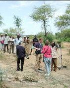
MEDIA COVERAGE
Project featured as CGIAR story
of the month (Feb 2006)
CGIAR scientists deploy Infra-Red scanners in fight against
hunger: Five developing countries to test new crop-boosting technique...
Learn more
|
OUR FINDINGS
This service requires downloading of the Google
Earth client, available at: earth.google.com. Do
not tilt view to the point where horizon is visable. If you do not see
data you may need to reduce tilt and/or zoom in closer. Do not try to
view many overlay layers simultanously (ie: Zoning + Earthquake Hazard.)
| 
West
Africa sites, Trends in Rain Use Efficiency (KML, Screenshot) |
|
| |
|
|